Ozark Trail: Courtois Section | Day 18
The FINAL DAY of my Ozark Trail thru hike; Courtois Section.
Disclaimer: This post contains affiliate links, which means I may receive a small commission if you purchase something through them at no extra cost to you! -michael

My Ozark Trail Backpacking Gear List
The FINAL DAY of my Ozark Trail Thru Hike! The day started with rain in the early morning hours, the first significant rainfall on my entire 18-day thru-hike, but it was gracious enough to stop by the time I started hiking. I hiked 23.1-miles on the Courtois Section passing by Bass’ River Resort, hiking through the Huzzah Creek Conservation Area, and ending at Onondaga Cave State Park, Ozark Trail Mile 0.
Courtois Section
Day 18 - October 31, 2024
Courtois Mile 23.5 to Ozark Trail Onondaga Terminus
Rate: Easy | Traffic: Moderate
Distance: 23.1mi | Elevation Gain: 2,539ft
Join AllTrails+ to get the most out of your hiking.
Courtois Section Ozark Trail Association Map
US Forest Service
Mark Twain National Forest
Potosi/Fredericktown Ranger District
10019 West State Highway 8
Potosi MO 63664
573-438-5427
www.fs.usda.gov/mtnf

Meeting Abby at Onondaga Cave State Park, the end of my Ozark Trail thru hike.
The First Rain on My Thru Hike
It started raining around 3:30 AM. Proper rain with thunder and lightning. It lasted for roughly three hours and started to let up around 6:45 AM, which was perfect timing as that’s when I would generally wake up on the trail. The world was wet, and there were still drops rolling off the leaves of the tree, but I was dry and ready to finish my journey on the Ozark Trail.

REI Trailmade 1 Tent with Footprint
The tent I had with me on the Ozark Trail was actually the REI Quarter Dome SL 1, but REI doesn’t make it anymore. The Trailmade 1 is their new version of the same product.

NEMO Tensor Trail Ultralight Insulated Sleeping Pad
Best sleeping pad I’ve ever owned! Easy to inflate and it holds are all night long.


Bass’ River Resort
Nine miles into my day the trail lead me down Butts Road through the heart of Bass’ River Resort, an expansive, beautiful resort with all the amenities that caters to all types of outdoor activities in Missouri. It was the first, and only time the trail passed by any sort of building, which was a bit odd and a bit welcoming. Because I hiked through on a Thursday in October, the resort was mostly empty, but still cool to see.


The Narrows
Between OT Map Mile 7-8 the trail traverses a ridge called “The Narrows” that is squeezed between Huzzah Creek to the west and Courtois Creek to the east. It’s a windy stretch of trail, and I was hoping to come across a spot that had good views of both sides, but alas the trees are too tall. There is however a great bluff view just south of The Narrows, my final bluff view of the hike.
Bat Cave
Roughly 1.5-miles after The Narrows the trail switches back and dips down to run along the bank of Courtois Creek. The large bluff on the western bank is pretty impressive. After a few hundred yards the trail comes alongside a large cave called Bat Cave. Sadly its gated off to people for the protection of the bats who call it home.


Forging Courtois Creek
Bat Cave is also where the trail crosses Courtois Creek. I was on the western bank and another hiker heading south was on the eastern bank. We both eyed the creek cautiously and searched for an easier crossing, because it was looking pretty deep. When we both realized this was the only way across we plunged in. The water came up to my belly button (I’m 6 feet tall). By far the deepest creek crossing I experience on the Ozark Trail. My butt was wet, but I only had 5 mile to go!


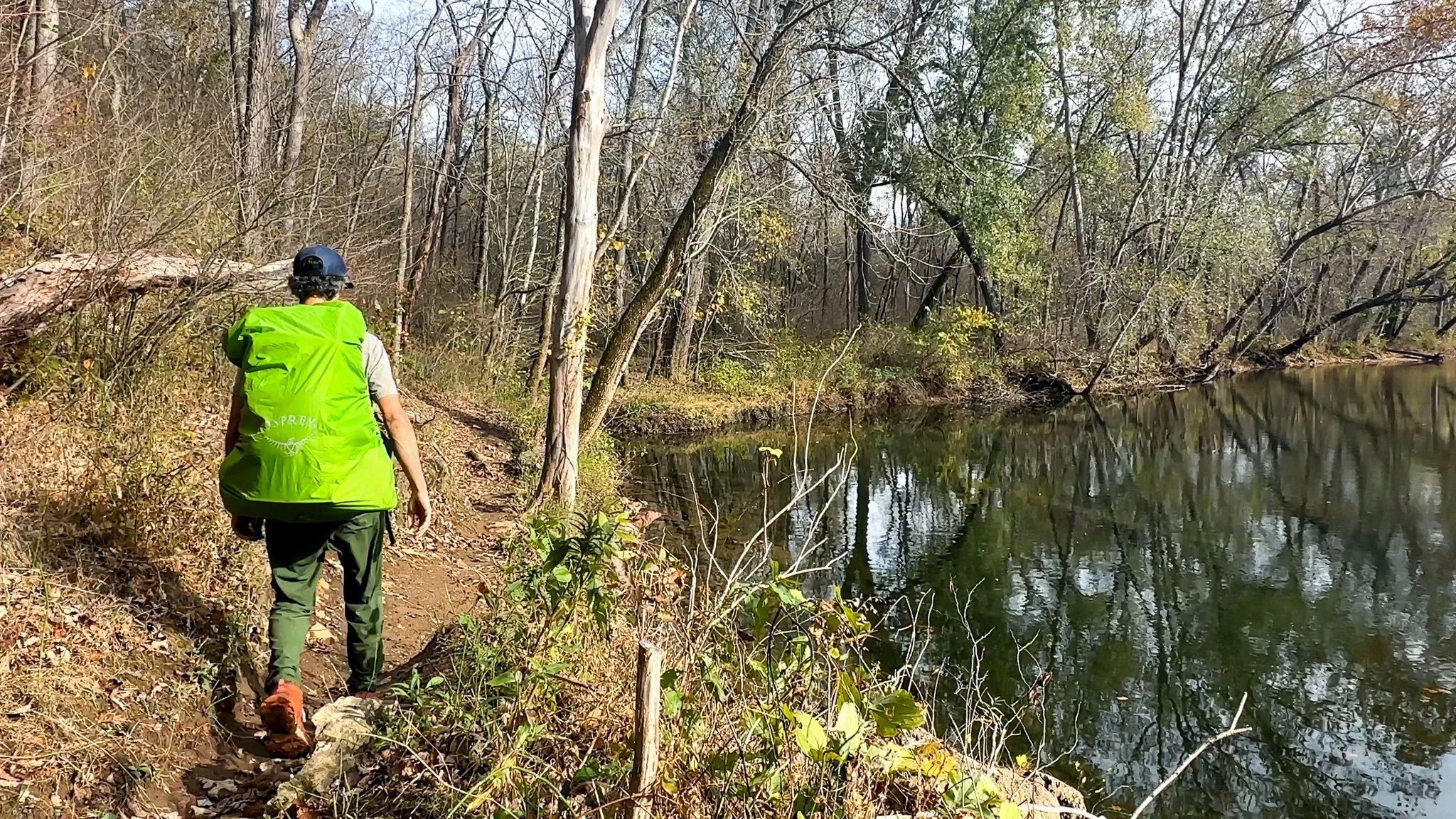
Huzzah Conservation Area
Crossing Courtois Creek brought me into the Huzzah Conservation Area primitive campground. There’s parking and a restroom right along the bank of Courtois Creek. The trail crosses through the parking lot and continues alongside the creek and the base of more bluffs dotted with smaller caves that are accessible. It’s a rather lovely campground.


Ozark Trail Mile 0 - Onondaga Terminus
Ozark Trail Onondaga Terminus
I’m not sure what I was expecting when I arrived and Ozark Trail Mile 0 in Onondaga Cave State Park, the terminus of my thru hike. A parade? An arch? At least a kiosk, right??! Nope. Mile 0 of the Ozark Trail is marked with a small post with an OT trail blaze nailed to it. Not much fanfare, but I kissed that trail blaze non-the-less.
Then it was a short walk down the road to the parking lot where Abby picked me up. I had completed my Ozark Trail Thru Hike.


Missouri’s Ozark Trail
The Ozark Trail contains over 430 miles of trail divided into 14 mostly connected sections throughout southeast Missouri. The established thru-hike covers eight of the connected sections and runs from Onondaga Cave State Park in Leasburg, roughly 84 miles southwest of St. Louis, to the Eleven Point Terminus near Thomasville, 23 miles north of the Arkansas border. Throw in the off-shoot Taum Sauk Section and you have nearly 300 miles of thru-hikeable trail.